
Norwich Transport Connections: Getting Around Norfolk and Further Afield
Norwich may sit amid the open landscapes of East Anglia, but the city offers a useful range of connections for work, education, leisure and everyday journeys. Rail services link Norwich with London, Cambridge, Stansted Airport and destinations across the region, while the A11 and A47 connect the city with the wider road network.
For people considering a move, the important point is not simply how to reach Norwich. It is the choice of ways to travel between the city, nearby communities, the Norfolk coast and destinations further afield.
Rail connections from Norwich
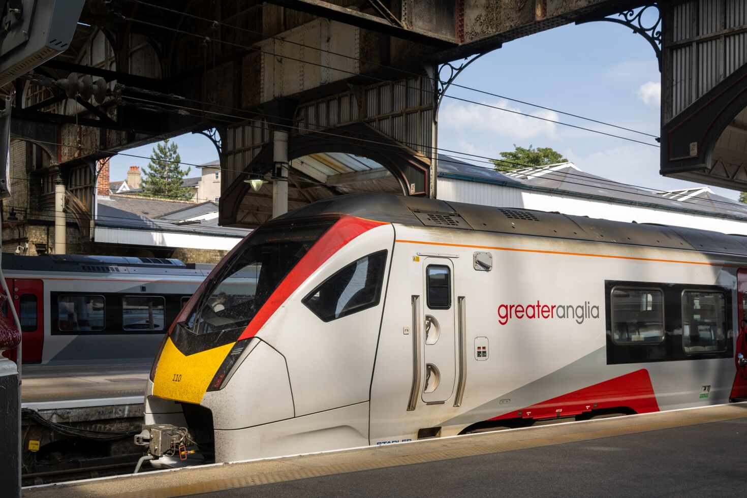
Norwich railway station sits close to the city centre and the Riverside area. Greater Anglia operates direct services between Norwich and London Liverpool Street. The route also serves key Essex and Suffolk destinations, making Ipswich and Colchester accessible without changing trains.
Direct Greater Anglia services also connect Norwich with Cambridge and Stansted Airport. For travel towards the Midlands and north-west, East Midlands Railway operates a regional route from Norwich through Ely, Peterborough, Nottingham, Sheffield and Manchester to Liverpool.
Within Norfolk, rail lines connect Norwich with places including Great Yarmouth, Lowestoft, Sheringham and Cromer. These routes can be useful for local journeys as well as car-free days at the coast. Timetables and stopping patterns change, so passengers should always check the relevant operator before travelling.
Rail travel from communities around Norwich
Several communities around Norwich have their own railway stations. Brundall is served by two stations, with connections into Norwich and towards Great Yarmouth and Lowestoft. North Walsham is on the Bittern Line between Norwich and Sheringham. This gives buyers the option of living outside the city while retaining a rail connection for work or leisure.
If rail access is a priority, look at the whole journey rather than the headline train time. Consider how you will reach the station, parking or cycle storage, service frequency and the time needed at the other end. Development pages provide local information, while live journey planners give the most reliable service details.
Road connections
The A11 is the principal route south-west from Norwich towards Thetford, Cambridge and the M11. The A47 runs east-west, connecting Norwich with Great Yarmouth and the coast in one direction and King's Lynn, Peterborough and routes towards the Midlands in the other.
Other routes serve the wider county: the A140 runs north towards Cromer and south towards Diss and Suffolk, while the A146 links Norwich with Loddon, Beccles and Lowestoft. These roads make Norwich a practical centre for a large part of Norfolk and north Suffolk.
Actual travel times can vary significantly by time of day, roadworks and the exact starting point. For that reason, it is more useful for an evergreen guide to explain the route network than to promise a fixed commute.
Park & Ride and buses
Norwich Park & Ride provides an alternative to driving into the centre. Services operate from sites around the city, including Airport, Sprowston, Postwick, Harford and Thickthorn. The different sites serve approaches from different parts of Norfolk, so residents can choose the most convenient option for their route.
Local and regional bus networks connect the city centre with residential areas, surrounding villages, employment sites, hospitals and education campuses. Routes and frequencies change over time, so it is sensible to check current operator information when planning a regular journey.
Norwich Airport
Norwich Airport is located to the north of the city. Its year-round KLM service to Amsterdam provides onward connections through a major international hub, while other scheduled and seasonal services cover a changing range of UK and European destinations.
The airport's presence is particularly convenient for residents who travel for work, visit family elsewhere in the UK or prefer to begin a holiday closer to home. Current routes vary by season and should be checked directly with the airport or airline.
Walking and cycling
Norwich's compact centre makes many journeys possible on foot. Cycle routes, shared-use paths and quiet streets provide further options, while longer trails connect the city with the countryside. Marriott's Way, for example, runs for 26 miles between Norwich and Aylsham via Drayton, Lenwade, Cawston and Reepham, following former railway lines.
For a household choosing where to live, access to a useful walking route, bus stop or local station can matter just as much as proximity to a major road. Thinking about the journeys you make most often will help identify the right side of Norwich - or the right nearby community - for you.
Well-placed homes around Norwich
Hopkins Homes has developments in several locations around Norwich, each with a different connection to the city. Church Farm in Drayton is positioned for access to north and west Norwich. Brundall Meadows benefits from village rail connections and access to the A47, while Loddon Rise is linked with Norwich by the A146 corridor.